Instead of
wasting florist foam, plaster, paint and other material, I tried to figure out
Clermont’s topography with SketchUp, a well-known 3D software. It was a good
occasion to find out if my general concept will work out or not.
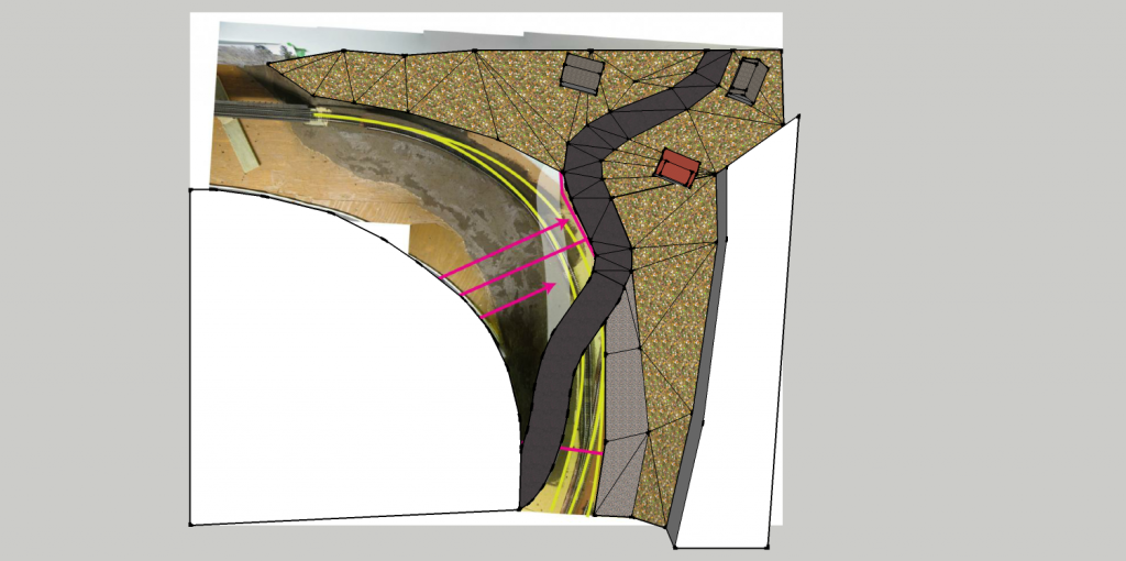 |
| Bird eye view of Clermont |
Before
starting, I had a few prerequisites: a road slope average of 10% (which is
usually found on old road in villages) and a grade crossing with an angle under
45 degrees. The road width would be 4 inches – about 30 feet in real life –
which is a standard.
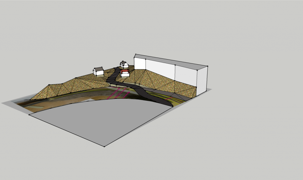 |
| General view of the scene |
I started
by scaling down my “Google Earth” photographic mosaic and draw the road.
Several key points had their elevation set and everything was linked together.
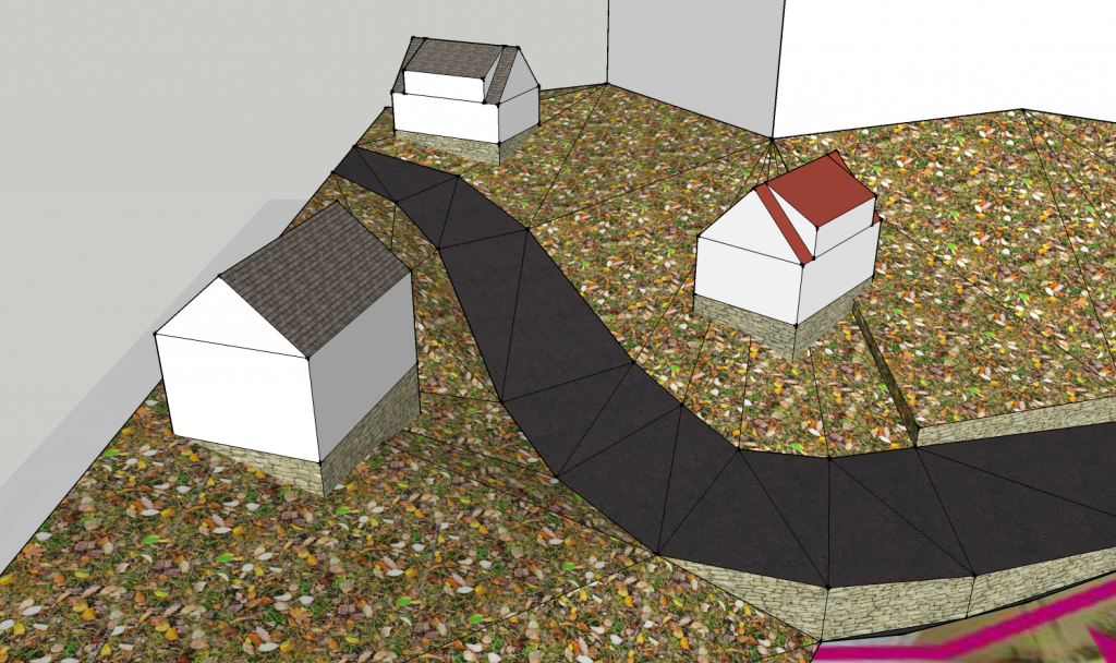
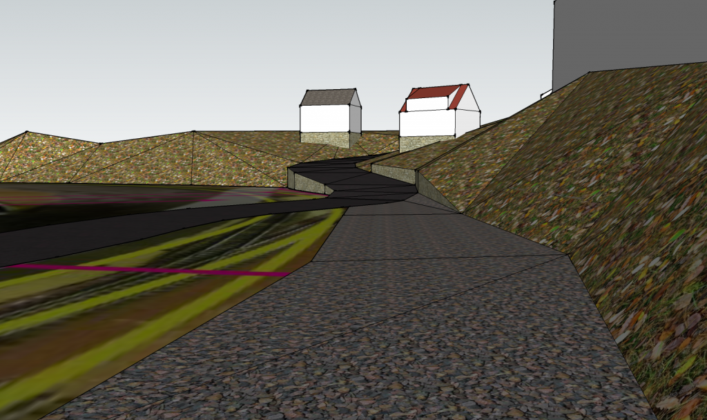 |
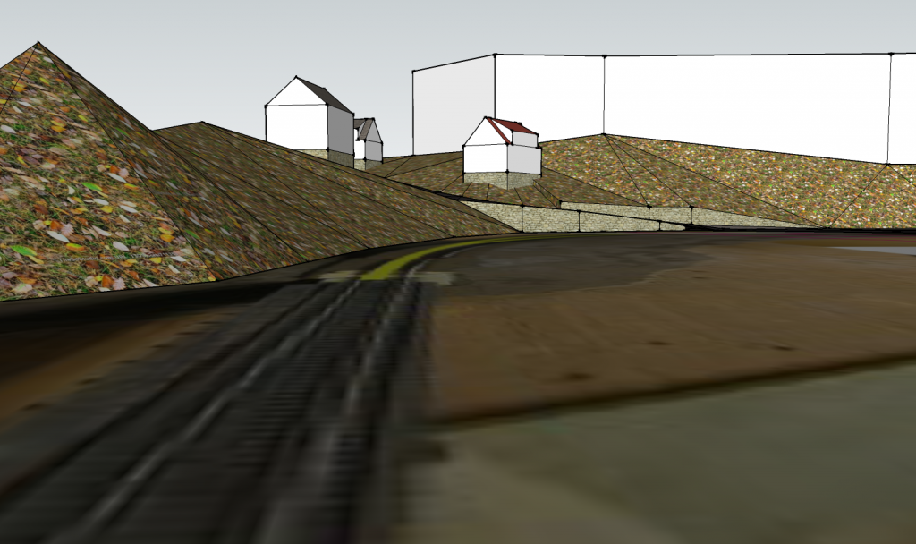
| Clermont seen from the team track |
When I was
satisfied with the slope profile, I build up the terrain using references from
already built parts. The upper town lies at 4 inches high (2 layer of
Styrofoam!). Near its vanishing point, the road width progressively shrinks
down to 3 inches to force the perspective a little bit. My idea is to make the
road ends at the top of a small hill. That way, you get the illusion the road
goes down after this point and it’s normal you don’t see it. Photobackdrop with
tricked perspective are nice, but I don’t have confidence this scene would be a
good contender for such a feat.
 |
| Clermont seen from the railway bridge |
Later, I
added a few buildings according to a recent mock up I did on the layout. This
is more a suggestion than a real proposition. But I think we clearly get the
feel of worker’s house built on cheap and sloped lots. Also, there progression
in the landscape helps to channel the forced perspective. My goal is to trick
the eye to follow the road because it’s where the layout is larger.
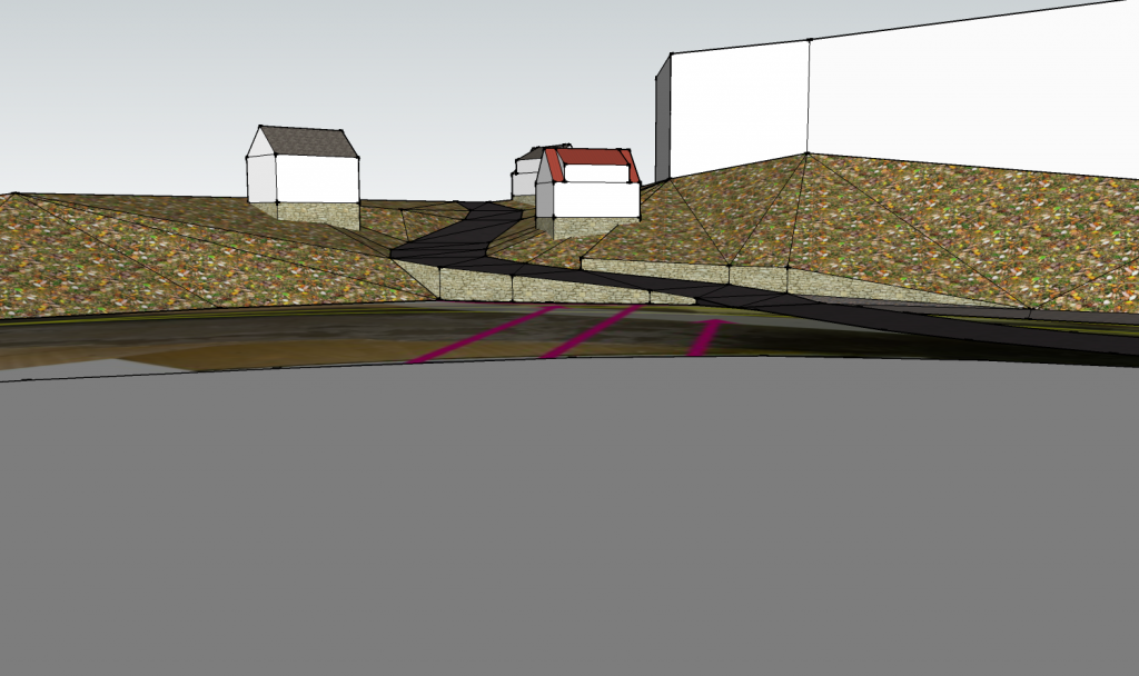
I also
added the stone retaining wall. It is a nice feature of the prototype. Also, on
older pictures from 2007, I found out there was a second retaining wall on the
other side of the road. Since then, it was replaced by an ugly concrete block
wall. I tried to capture these little details that help to clearly locate the
scene in Clermont.
 |
| Saint-Philippe Street and its stone retaining walls. |
It was also
a good opportunity to verify if there is enough space for the team track. I
feel confident a semi-trailer truck won’t look cramped there. On the prototype,
this storage track follows closely the land forms and there’s no space for a
road.
Street naming
It may sound easy, but finding nice sounding street names for the layout isn't as easy as one could think. In fact, it's not that hard, but since I took some liberties with Clermont, I must try to keep things as prototypical as I can.
The first street is only depicted on the photo backdrop, between the paper mill and the bridge. This real street is called simply Donohue Street (Rue de la Donohue). That's a given.
On the other side of the river, things are a little bit more complex. On the prototype, two roads meet at the crossing. I only modelled one. The north one is Maple Street (Rue des Érables). Is there a more common street name in Canada? I dropped it. I didn't model this street though it inspired me for the houses location. Also, it's generic name doesn't set the locale at all. The other street is Saint-Philippe Street. It is the road with the stone retaining wall. I like this one better. Sounds clearly French Canadian. Also, having a saint name clearly marks this one as a very old main street connecting the town to the outside world. In Quebec, most streets had saint names until the 60s. This is also a good excuse to have a few older and more traditional houses. Until the 1920s, residential architecture in Quebec had its own set of design patterns that made them unique in North America. After WWI, most of those specific traits disappeared. I plan to have a mix of ordinary houses there. A settler's one from the 1850s, a modern 70s bungalow and a two-storey high old duplex from the early 1900s. Those are typical of Clermont and are found altogether everywhere in the town.
Then, the last remaining street to be name is the one along Clermont station. This road follow the river and link a nearby industrial park served by the team track. The real road is called River Street (Rue de la rivière) which makes sense! Thus, the street portion between the fascia and the crossing will be River Street.
No comments:
Post a Comment